Blog
Indrahar Pass, and whose road it really is
We have previously refused to print a height for Indrahar Pass, because every figure we could find was somebody's recollection. That has changed, and the number is about 4,340 m. The other thing worth saying is that this is not a trekking route shepherds happen to use. It is the reverse.
Written by the people who drive these roads · Last checked
The short answer
Indrahar Jot is about 4,340 m, on the Dhauladhar crest north of Dharamshala, and crossing it takes two to three days from the road head at Gallu Devi and lands you in Chamba district. Triund at 2,828 m is barely halfway up. It is a guided objective with snow on it well into the season, and it has been a working shepherds' crossing far longer than it has been anything else.
The facts, in one place
- Indrahar Jot is about 4,340 m, now backed by two independent sources that agree.
- The pass stands roughly 3,000 m above Dharamshala town, which sits at 1,314 m.
- Gallu Devi, where the road ends above Dharamkot, is 5 km from McLeod Ganj.
- Triund at 2,828 m is barely halfway — the pass is another 1,500 m above it.
- Crossing Indrahar takes two to three days and puts you down in Chamba district.
- 1,314 mDharamshala
- 2,130 mGallu Devi
- 2,828 mTriund
- 4,340 mIndrahar Jot
Read the whole postClose the post
This site has been unwilling to give a height for Indrahar Pass. Our post on the treks near Dharamshala says as much: published figures vary by a couple of hundred metres, none of them could be traced to a survey, and we would rather say nothing than print a confident guess.
That position was right and it is now out of date. Asked directly, the open mapping record carries a surveyed height for the pass, and an independent terrain model agrees with it to within about twenty-five metres. So:
Indrahar Jot is about 4,340 m.
It is also, and this is the part that gets left out entirely, not primarily a trekking route.
The numbers, and how solid each one is
| Place | Height | How well sourced |
|---|---|---|
| Dharamshala | 1,314 m | Terrain model |
| Triund | 2,828 m | Operator-checked, long-standing |
| Indrahar Jot | about 4,340 m | Survey plus terrain model, agreeing |
Three thousand metres separate the town from the pass. That single line explains most of what follows — the days it takes, why acclimatisation matters, and why people who found Triund straightforward get into difficulty higher up.
From where the road stops
The road ends at Gallu Devi, above Dharamkot, 5 km from McLeod Ganj and about 2,130 m up. That is the whole of what a car does here — roughly a quarter of the height between the town and the pass — and we would rather be blunt about it than have you book one expecting more.
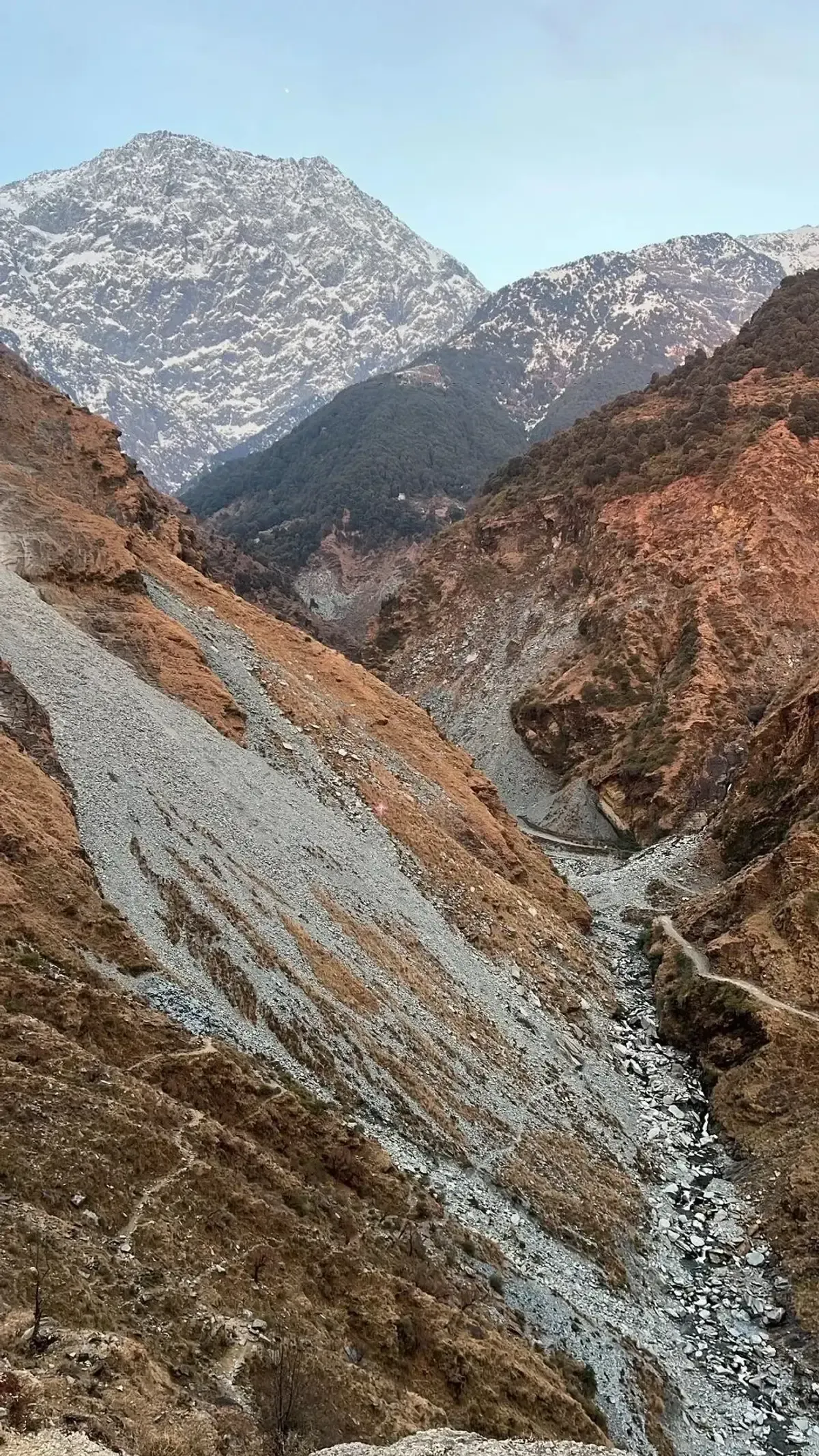
From there the route is the Triund path for the first day, which means the opening stretch is ground a great many people have walked as an afternoon excursion. Triund at 2,828 m feels like an arrival. It is not one. The pass is another 1,500 m above it, and everything hard is in that upper half — the shoulder above the ridge, the boulder ground, the snow that sits in the gullies long after it has gone from the meadow.
Two to three days to the pass. Longer if you go over and down into Chamba instead of turning round, which is the proper version of the trip and the one the route was made for.
What the crossing actually asks
Above 4,000 m, on loose steep ground, with snow present well into the season and weather that arrives faster than you can descend. The pass is normally crossed early in the morning for exactly that reason.
Take a guide. We say that about almost nothing on this site — Triund needs nobody, Kareri needs one only in cloud — and we say it about Indrahar without qualification.
Going from 1,314 m to 4,340 m inside three days is also a real altitude gain by any measure. Our altitude guide sets out what that does to people and what the warning signs are. The short version is that being fit is not the same as being acclimatised, and the fittest member of a group is often the one who gets into trouble, because they got high fastest.
Whose crossing this is
Indrahar is a working route. It was one long before anybody walked it for pleasure, and it still is.
The Gaddis are a pastoral community centred on Bharmour, over in Chamba, and their year is built around moving flocks of sheep and goats between low winter grazing in the foothills and high summer pasture on the far side of this range. Getting between the two means crossing the Dhauladhar, and Indrahar is one of the passes they use. So is Minkiani, further west above Kareri Lake.
If you cross in season you will very likely meet a flock coming the other way, with two or three men and a dog moving several hundred animals over ground you are picking your way across. It reorganises your sense of the achievement, somewhat.
We are going to stop there rather than pad this out. We know the pattern because we live below it and we drive Gaddi families to and from the roadhead. We do not have sourced figures for how many households still move, how large the flocks run, or on what dates they cross — those numbers exist in the literature and we have not read it properly, so we are not going to repeat half-remembered versions of them here. Ask somebody in Bharmour, who will know.
When it is open
Roughly mid-June to early October. The snow sets the window, not the calendar, and it varies by a fortnight either way from one year to the next.
Late September and the first half of October are the best of it: settled weather, firm ground, clear air, and the flocks already coming down. July and August are the monsoon, which on this side of the range means poor visibility and worse footing.
What we would actually tell you
If you have walked to Triund and enjoyed it and are wondering what is next, the honest answer is Kareri Lake, not this. Indrahar is two or three grades harder than the thing that prompted the question.
If you do want it, come in late September, take a guide from Dharamshala who has crossed it, allow enough days that the weather can cost you one, and go over rather than up-and-back. The far side is the point.
And book the car for Gallu Devi and for the day you come down, and nothing in between. There is nothing in between for us to sell.
Also asked
Questions that come up
How high is Indrahar Pass?
About 4,340 m. We would not give a figure at all until recently, because published heights for it varied by a couple of hundred metres and none could be traced. There is now a surveyed height in the open mapping record and a terrain model that agrees with it to within about 25 m, which is the standard we hold ourselves to.
How long does the Indrahar Pass trek take?
Two to three days from Gallu Devi to the pass, and longer if you carry on down the far side into Chamba rather than turning back. Nobody sensible does it in one. The camps people use are at Triund and above it, and the pass is usually crossed early in the morning.
Where does the Indrahar Pass trek start?
At Gallu Devi above Dharamkot, which is 5 km from McLeod Ganj by road and the last place a vehicle reaches. The first part of the route is the Triund path, so the opening day is a walk many people have already done as a day trip.
Is Indrahar Pass difficult?
Yes, by the standards of anyone whose experience is Triund. It is above 4,000 m, it holds snow late, the last section is loose and steep, and the weather on the crest changes faster than you can walk out of it. Take a guide. We say this about very little on this site.
What is the best time to cross Indrahar?
Roughly mid-June to early October, and the snow decides rather than the calendar. Late September and early October give the most settled weather and the clearest air. The monsoon in July and August makes the ground and the visibility both worse.
Who are the Gaddi shepherds?
A pastoral community centred on Bharmour in Chamba, who move flocks of sheep and goats between low winter grazing in the foothills and high summer pasture, crossing the Dhauladhar passes twice a year to do it. Indrahar is one of the crossings they use.
Can I drive any part of the Indrahar Pass route?
Only to Gallu Devi, and that is the whole of it. There is no vehicle access beyond the road head, none on the far side until you are well down into Chamba, and no road over the range anywhere near here. Anyone offering you a drive to the pass is selling you a drive to Gallu Devi.
Keep reading