Blog
Dharamshala to Barot Valley
It is 111 km and it takes about four hours, which is a slower average than almost any other road out of Dharamshala. The reason is the last thirty kilometres. Here is the whole drive, junction by junction, and what to do when you get there.
Written by the people who drive these roads · Last checked
The short answer
Barot is 111 km from Dharamshala by road and takes three and a half to four hours in a car. The route runs Dharamshala – Palampur – Baijnath – Jogindernagar – Ghatasani, and then turns north for the last 40 km into the Uhl valley. That final stretch is single track with hairpins and is what makes a 111 km drive take four hours.
The facts, in one place
- Dharamshala to Barot is 111 km by road, measured on OSRM rather than estimated.
- The drive takes three and a half to four hours, an average of under 30 km an hour.
- The last 40 km, from Ghatasani, is single-track road with hairpins and passing places.
- Barot village sits at about 1,800 m, roughly 600 m above Baijnath down in the Kangra valley.
- April to June and September to November are the months to come; the road in is poor in heavy rain.
- Dharamshala → Palampur36 km
- Palampur → Baijnath20 km
- Baijnath → Jogindernagar30 km
- Jogindernagar → Ghatasani15 km
- Ghatasani → Barot40 km
Read the whole postClose the post
There is a question people have been asking Google for months that this site had no answer to, and it is a fair question with a genuinely surprising answer. Dharamshala and Barot are about 50 km apart on a map. The drive is 111 km and takes four hours.
That is not a bad road being described badly. It is what happens when the direct line between two places runs over a ridge with nothing on it, and the road has to go round.
The route, junction by junction
| Section | Distance | Road |
|---|---|---|
| Dharamshala → Palampur | 36 km | Two-lane state highway, fast |
| Palampur → Baijnath | 20 km | Same, through tea country |
| Baijnath → Jogindernagar | 30 km | Wider, drops into the Uhl catchment |
| Jogindernagar → Ghatasani | 15 km | Fine, last proper town |
| Ghatasani → Barot | 40 km | Single track, hairpins, slow |
The total on that table is a little over 140 km, because it is written as a sequence of towns and the road does not actually visit all of them in a straight sequence — routed properly, avoiding the detour into Baijnath town centre, it comes to 111 km. Going through Baijnath itself adds about six kilometres. It is worth the six kilometres if you have not seen the temple.
Why four hours
The arithmetic is the same one we set out in how long Himachal drives take, and Barot is close to the worst case on it.
The first 85 km, as far as Ghatasani, run at something like 45 km an hour. That is a bit under two hours. The last 40 km run at nearer 20. That is another two. So a road that is two thirds highway spends half its time on the final third.
This is the single most useful thing to know about this drive, and it is why people who plan it off a map arrive three hours later than they meant to. The distance is not the problem. The last 40 km is the problem.
What the last 40 km is actually like
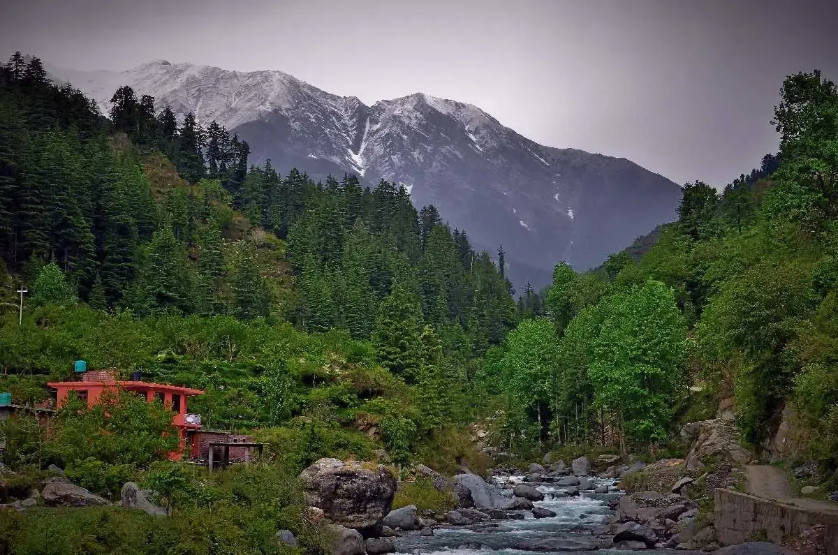
From Ghatasani the road turns north and climbs into the Uhl valley. It is single track for most of what remains, with passing places rather than a second lane, and a good number of hairpins. The surface is tarmac and is mostly sound. There are drops, and there are not always barriers.
None of that makes it a difficult road. We take a Dzire up it without thinking about it. What it makes it is a slow road, and one where meeting a bus coming the other way costs you five minutes of reversing rather than five seconds of pulling over.
Two conditions change the picture:
- Heavy rain. This is the wet side of the Dhauladhar and the monsoon here is not a shower. The Ghatasani–Barot section is the kind of hillside road that gets closed by a slip, and July and August are when that happens.
- Winter. The road stays open, but the valley is cold, the days are short, and the last section can carry ice in the mornings. Barot in January is a real thing to do, but it is not a casual one.
Where the road actually goes
Barot exists because of the Shanan hydroelectric project, and the valley still carries its infrastructure — the reservoir, the old haulage trolley line up from Jogindernagar, the diversion on the Uhl. It is a working valley more than a resort one, which is most of its appeal.
The river is a trout river; there is a hatchery. The Nargu wildlife sanctuary is on the far bank. And the walking is genuinely good: this is the Barot side of the Thamsar Pass, and the trail over it runs to Rajgundha and down to Bir. We have written that up separately, because the road answer for Rajgundha is completely different — see Dharamshala to Rajgundha.
Stops on the way
You do not need to stop, but two are worth the time.
Baijnath. The Shiva temple here is 13th century, is still in use, and is about two minutes off the road. If you only stop once, stop here.
Jogindernagar. Last proper town, last reliable fuel, and the bottom of the old haulage trolley. Fill up here. There is fuel closer to Barot but not dependably.
What we would actually tell you
If you have four days in the Kangra area and you are choosing between Barot and somewhere better known, Barot is the better choice — provided you give it two nights. The drive is too long for one.
If you have two days, do not come to Barot. Go to Bir, which is an hour and a half closer, and keep Barot for a trip that has room for it.
And if what you actually want is the high meadow at the top of the valley rather than the valley floor, the honest answer is that Barot is the long way round to it. The short way is from Bir, on foot, and that is a different trip entirely.
Also asked
Questions that come up
How far is Barot Valley from Dharamshala?
111 km by road. That is the figure a routing engine returns for the normal route, and it matches what our cars run. Be careful with straight-line distances: Barot is only about 50 km from Dharamshala as the crow flies, and the gap between those two numbers is the whole character of the drive.
How long does the Dharamshala to Barot drive take?
Three and a half to four hours, without stopping for anything other than tea. That is an average of under 30 km an hour, which is slow even by Himachal standards. Anyone quoting you two and a half hours has not driven the section above Ghatasani.
Is the road to Barot Valley good?
The first two thirds are fine — proper two-lane state highway through Palampur and Baijnath, then on to Jogindernagar. The last 40 km from Ghatasani is the problem: single track for much of it, hairpins, and passing places you have to reverse to. It is perfectly drivable in a normal car in dry weather. It is not a road to be on in heavy rain.
What is the best time to visit Barot Valley?
April to June, and September to November. Spring gives you the valley green and the Uhl full; autumn gives you the clearest air of the year. Avoid July and August — this is the Kangra side of the Dhauladhar and the monsoon here is serious, and the road in is exactly the kind that gets cut by a slip.
Can I do Barot as a day trip from Dharamshala?
You can, and we would rather you did not. Four hours each way leaves you about three hours in the valley for eight hours in the car, which is a bad trade for somewhere whose entire appeal is that there is nothing to rush for. Two nights is right. One night works if you must.
Is Barot Valley in Kangra or Mandi district?
Mandi. Barot sits in Padhar tehsil of Mandi district, even though the usual way in is through Kangra district and most people arrive from Dharamshala or Bir. The district boundary runs along the ridge you cross after Ghatasani.
Keep reading