Blog
Dharamshala to Rajgundha, where the road ends
You cannot drive to Rajgundha. The tarmac stops at Billing, 79 km from Dharamshala, and the last eleven kilometres are a rough track most people walk. Here is what the drive is, where it really ends, and what the walk in costs you.
Written by the people who drive these roads · Last checked
The short answer
There is no road to Rajgundha. Drive Dharamshala to Billing — 79 km, about three hours — and the tarmac ends there at 2,400 m. Beyond it is roughly 11 km of rough track to Rajgundha, walkable in four to five hours or drivable only in a high-clearance vehicle in dry conditions. Rajgundha itself sits at about 2,500 m.
The facts, in one place
- Dharamshala to Billing, the last point on tarmac, is 79 km and about three hours.
- Beyond Billing there are roughly 11 km of rough track to Rajgundha, usually walked.
- Billing sits at about 2,400 m and Rajgundha at about 2,500 m — barely 100 m apart in height.
- From Bir it is 13.5 km up to Billing and 24.8 km to Rajgundha, which is the shortest approach.
- Rajgundha and Barot are 9 km apart on foot over the Thamsar Pass but 76 km apart by road.
- Bir → Billing13.5 km
- Bir → Rajgundha road head24.8 km
- Dharamshala → Billing79 km
- Dharamshala → Rajgundha90 km
Read the whole postClose the post
This is a question with a straight answer that almost nothing on the internet gives you: you cannot drive to Rajgundha.
Every distance you will find quoted for it — ours included, at ninety-odd kilometres — is a routing engine doing its best with a village that has no road. The useful number is where the tarmac actually stops, and that is Billing.
The drive, and where it ends
| From | To | Distance | Notes |
|---|---|---|---|
| Dharamshala | Billing | 79 km | About three hours. Tarmac all the way |
| Bir | Billing | 13.5 km | The climb, 14 switchback kilometres |
| Bir | Rajgundha | 24.8 km | Only 13.5 of it is road |
| Baijnath | Rajgundha | 35 km | Same story — 21 km of it is track |
| Barot | Rajgundha | 76 km | By road. Nine on foot |
Read down the right-hand column and the shape of the place appears. Everything here is close to everything else and almost none of it is connected.
Billing, and what 2,400 m means
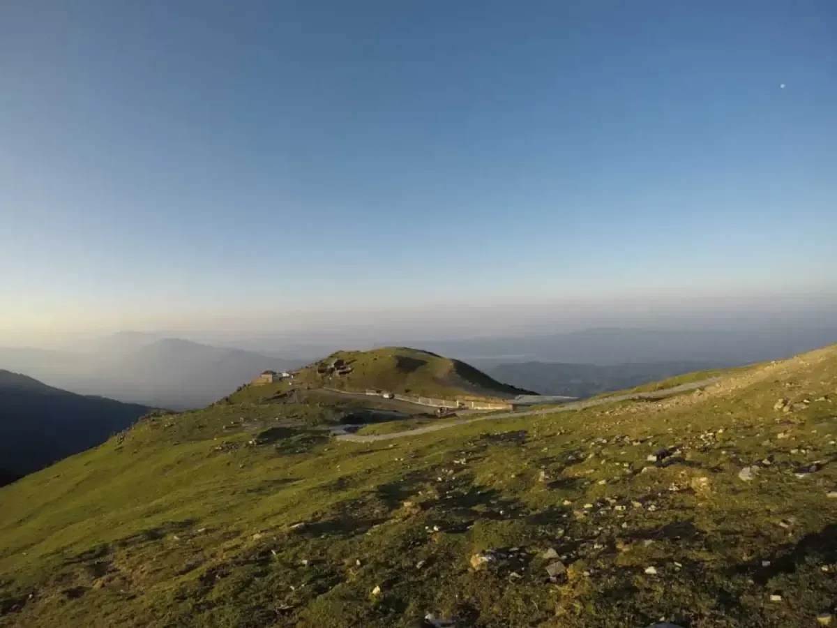
Billing is the paragliding launch above Bir, and it is where your car stops. It sits at about 2,400 m, roughly 850 m above Bir, up fourteen kilometres of tight switchbacks that take a good forty minutes on their own.
It is worth saying plainly that Billing on its own is a destination. There is a meadow, there is the whole Kangra valley laid out below you, and in season there are thirty canopies in the air at once. A lot of people who search for Rajgundha would be happy stopping here, and we would rather tell you that than drive you somewhere you did not want to go.
If you have altitude to think about, 2,400 m in a car in three hours from 1,300 m is a fast gain. Our altitude guide covers what that does and does not mean.
The eleven kilometres beyond
From Billing a rough track continues over the shoulder and down into the Rajgundha bowl. OpenStreetMap carries about eleven kilometres of it, which matches what it feels like on foot.
Two ways to cover it:
Walk. Four to five hours, and the normal choice. It is not steep in net terms — Rajgundha is at about 2,500 m, so you finish barely a hundred metres higher than you started — but it rolls, and the ups and downs are what tire people who read the altitude figures and expected a stroll.
Jeep. Local high-clearance vehicles do run it in dry weather. We do not put guests in one, partly because the track is genuinely rough and partly because it is the wrong way to arrive somewhere whose whole point is quiet.
The Thamsar Pass, and the 9-versus-76 problem
Rajgundha sits at the western end of a walking route that crosses the Thamsar Pass and comes down into Barot. On foot the two valleys are about nine kilometres apart and it is a hard, high day.
By road they are 76 km apart, because there is no connection whatsoever and you have to descend to Baijnath and go round via Jogindernagar and Ghatasani.
We have written the Barot drive up on its own — see Dharamshala to Barot Valley — but the planning consequence is worth stating here. People routinely ask us to “do Rajgundha and Barot” as one loop. As a walking trip that is a real and excellent route. As a driving trip it is two separate journeys with a long day of road in between, and it is almost always better to pick one.
When to go
Roughly April to June and September to November, which is the same window as most of this side of the Dhauladhar.
- April–June. The meadow greens up, the track dries out, and Billing is busy with gliders. This is the season.
- July–August. Monsoon. The track becomes mud, the walk stops being fun, and the switchbacks up to Billing are no place to be in a downpour.
- September–November. The clearest air of the year and the best views from Billing. It gets cold in the valley at night from late October.
- December–March. Snow. The track is not a walking proposition for casual visitors and the Billing road itself can close.
What we would actually tell you
The honest version, which loses us a fare about half the time:
If you want to see this landscape and you have one day, we will drive you to Billing and you will get most of what you came for. If you want Rajgundha itself, budget two nights — drive to Bir, sleep, walk in the next morning, sleep there, walk out. And if somebody has sold you a “drive to Rajgundha valley”, ask them where exactly they intend to stop, because it will be Billing.
Also asked
Questions that come up
How far is Rajgundha from Dharamshala?
About 90 km in total, but only 79 km of that is road. The tarmac ends at Billing and the remaining eleven kilometres or so are a rough track. If you are asking so you can plan a drive, the number you want is 79 km to Billing, roughly three hours.
Can you drive all the way to Rajgundha valley?
Not in an ordinary car, and not reliably in anything. There is a rough track beyond Billing that a high-clearance vehicle can sometimes manage in dry weather, and local jeeps do use it. We do not take guests up it. Our cars stop at Billing and you walk from there, which is what almost everybody does.
How long is the walk from Billing to Rajgundha?
Around eleven kilometres, and four to five hours at a normal pace. It is not a technical walk and it does not climb much overall — Billing is about 2,400 m and Rajgundha about 2,500 m — but it undulates a good deal in between, so the flat-looking numbers understate it.
How far is Rajgundha from Bir?
24.8 km, of which 13.5 km is the road up to Billing. Bir is the shortest approach to Rajgundha from anywhere and is where most people start.
How do you get from Rajgundha to Barot?
On foot, over the Thamsar Pass — about 9 km of walking, and a serious day. By road it is 76 km, because the two valleys have no road connection at all and you have to go all the way back down to Baijnath and round. That gap between 9 km and 76 km is the single most useful fact about this corner of Himachal.
Is Rajgundha worth it?
If you want a high meadow valley with almost nothing in it and you are happy to walk five hours to get there, yes. If you are looking for a drivable viewpoint, no — go to Billing, which has the view and a road, and turn round.
Keep reading